
Images
New England Usa Pictures, Images and Stock Photos
Browse 268,300+ new england usa stock photos and images available, or search for new england usa map to find more great stock photos and pictures.
Most popular
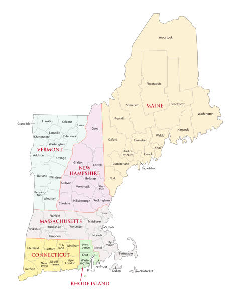
New England region, colored map. A region in the United States of America, consisting of the six states Maine, Vermont, New Hampshire, Massachusetts, Rhode Island and Connecticut. Illustration. Vector

New England region of the United States of America, gray political map. The six states Maine, Vermont, New Hampshire, Massachusetts, Rhode Island and Connecticut with capitals. Illustration. Vector.
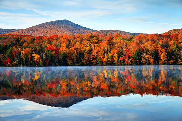
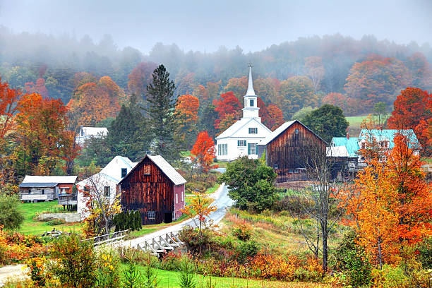
Early morning autumn light near Killington, Vermont. Photo taken on a calm tranquil colorful morning during the peak autumn foliage season. Vermont's beautiful fall foliage ranks with the best in New England bringing out some of the most colorful foliage in the United States

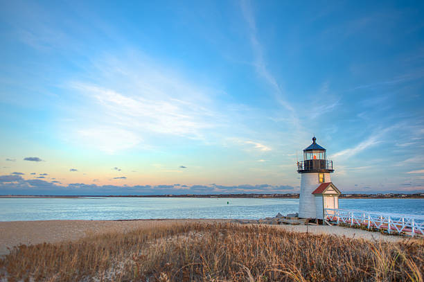
Landscape image taken from shore on a desolate day at Brant Point in Nantucket MA
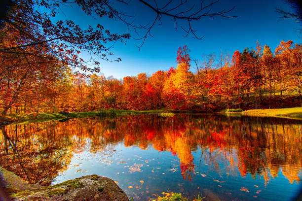
Vermont fall foliage
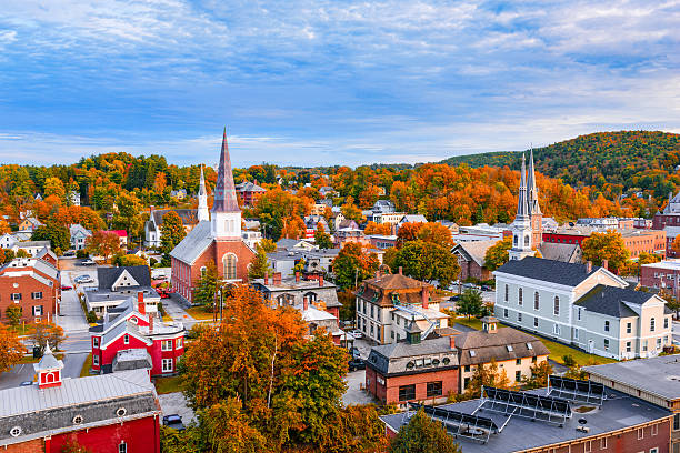
Montpelier, Vermont, USA autumn town skyline.

Aerial view of Mountain Forests with Brilliant Fall Colors in Autumn at Sunrise, Adirondacks, New York, New England

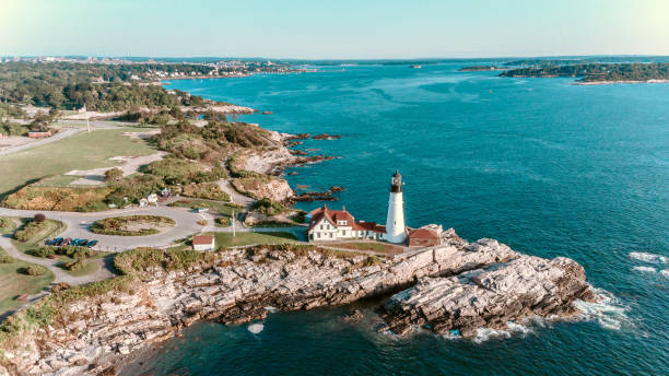
Portland, Maine, USA at Portland Head Light.
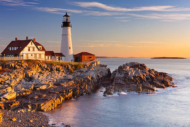
The Portland Head Lighthouse in Maine, USA at sunrise.
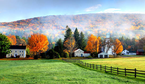
Autumn fog in the village of Tyringham in the Berkshires region of Massachusetts

Map of United States split into Census regions and divisions. Region definition, widely used for data collection and analysis. Most commonly used classification system. English. Illustration. Vector
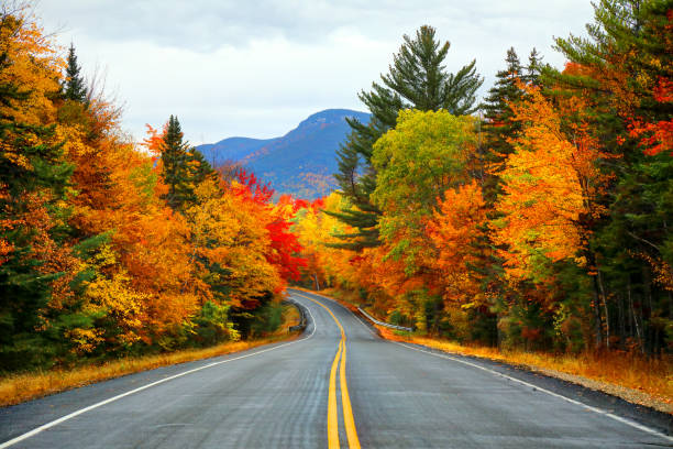
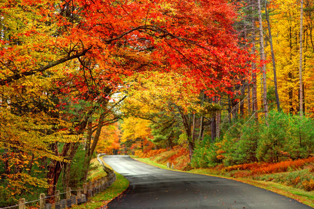
Autumn road in the White Mountains of New Hampshire in autumn.
Vector illustration
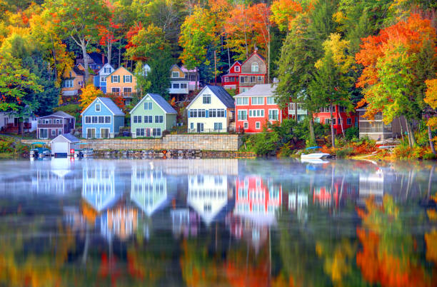
Lake Winnipesaukee is the largest lake in the U.S. state of New Hampshire, located in the Lakes Region. Lake Winnipesaukee has been a popular tourist destination for more than a century, particularly among residents seeking a safe haven from the summer heat of Boston and New York City.
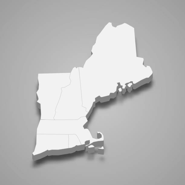
3d isometric map New England Region of United States, isolated with shadow
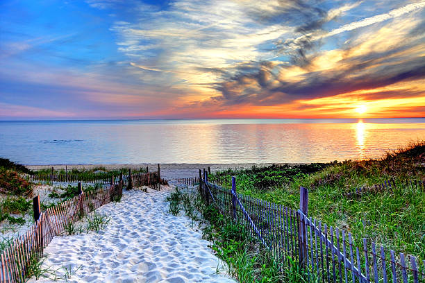
Path with beach fence leading to a secluded beach at sunset near Provincetown on Cape Cod. Cape Cod has some of the worlds most beautiful beaches. Cape Cod is famous, worldwide, as a coastal vacation destination with some of New England's premier beach destinations
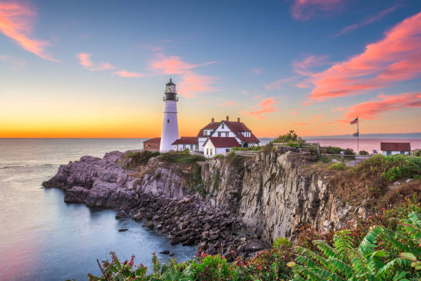
Portland, Maine, USA at Portland Head Light.

An American flag flies from the open porch and gardens surround a small single family home on a Spring afternoon on Cape Cod on the Massachusetts coast.

Woman hiking at Artist's Bluff in autumn. View of Echo Lake. Fall colours in Franconia Notch State Park. White Mountain National Forest, New Hampshire, USA
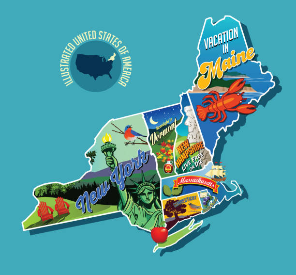
Illustrated pictorial map of Northeast United States. Includes Maine, New Hampshire, Vermont, Massachusetts, Connecticut, Rhode Island and New York. Vector Illustration.
Peak autumn foliage near rural Waits River in Vermont

Sailboats on the Charles River with Boston's Back Bay skyline in the background. Boston is the largest city in New England, the capital of the state of Massachusetts. Boston is known for its central role in American history,world-class educational institutions, cultural facilities, and champion sports franchises.

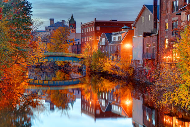
Providence is the capital and most populous city of the state of Rhode Island and is one of the oldest cities in the United States.

White clapboard house with a white picket fence

Exterior of a new Cape Cod styled suburban house with recently planted shrubs and grass

Annisquam Harbor Light Station is a historic lighthouse on Wigwam Point in the Annisquam neighborhood of Gloucester, Massachusetts.
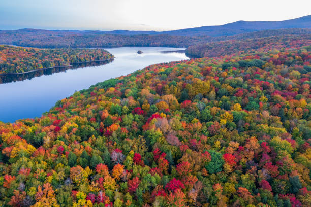
Aerial view of the colorful foliage at Lake Whitingham (The Harriman Reservoir) in the Green Mountains of Vermont.
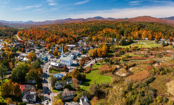
Panoramic aerial view of the town of Stowe in Vermont in the fall

Portsmouth, New Hampshire, USA townscape.
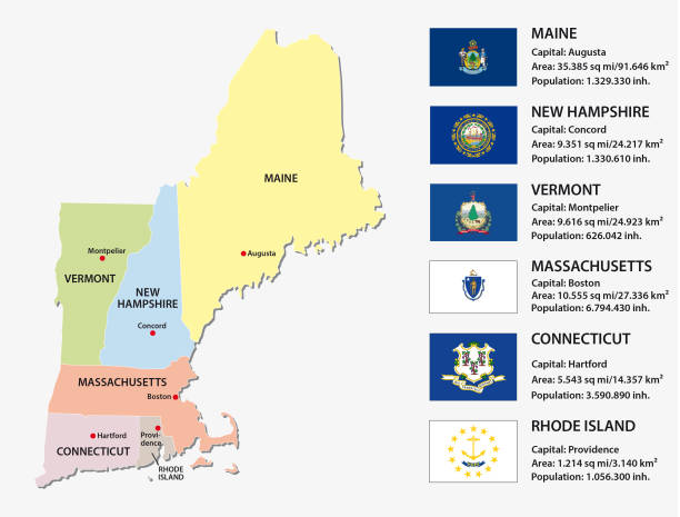
New england states vector map with flags
Medford is a city 3.2 miles northwest of downtown Boston on the Mystic River in Middlesex County, Massachusetts, United States.

Country Dirt Road With Autumn Foliage Of A Large Sugar Maple In Vermont, USA

Beautiful colonial American house at sunset
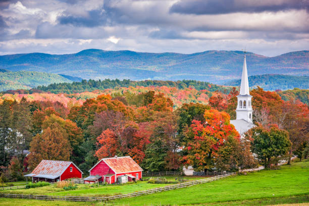
Peacham, Vermont, USA rural autumn scene.
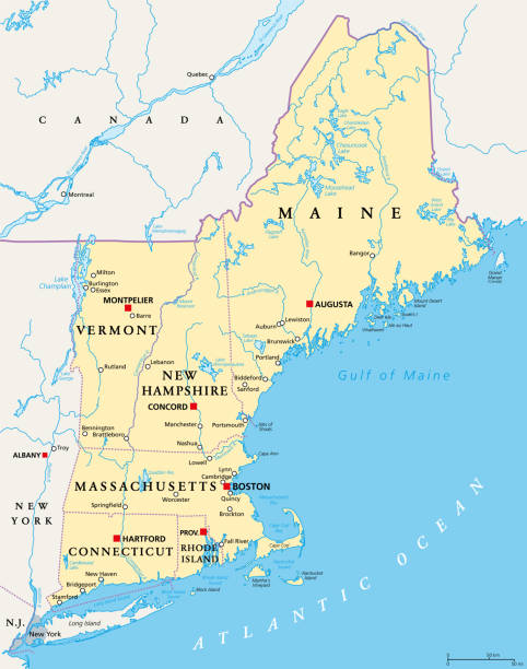
New England region of the United States of America, political map. Maine, Vermont, New Hampshire, Massachusetts, Rhode Island and Connecticut with their Capitals and borders. Illustration. Vector.

New england states road vector map


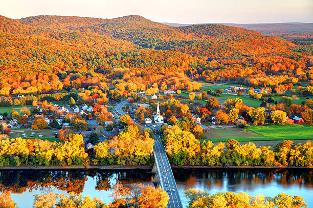
Connecticut River winding through the Poineer valley region of Massachusetts. Photo taken from a scenic viewpoint on Sugurloaf Mountain in Sunderland at dusk. The Pioneer Valley is known for its scenery and as a vacation destination and its beautiful fall foliage ranks with the best in New England
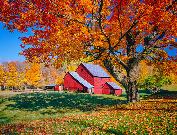
Autumn country side with rolling hills in Vermont with old weathered barn
New england states vector map

two fences frame the pathway to the beach at Provincetown Massachusetts, at sunset

View of Boston in Massachusetts, USA at night showcasing its Christmas lights at Commonwealth Evenue.

Watercolor-style rendering of New England map. File is layered with water, land, surrounding land, outline, and cities/text on five separate layers to easily hide or remove elements. Outlines can be easily removed for plain watercolor rendering. File contains flat color and simple gradient blends.
Scenic Autumn Road in the Quabbin Reservoir Park area of Massachusetts.

a red bridge is snow covered in the winter

Beautiful colonial style house at sunset

Beach path in Narragansett, Rhode Island. Early morning.

Faneuil Hall rooftops covered in snow during the winter season in Boston. Faneuil Hall Also known as Quincy Market is located near the waterfront and Government Center, in Boston, Massachusetts, has been a marketplace and a meeting hall since 1743. Boston is the largest city in New England, the capital of the Commonwealth of Massachusetts
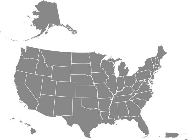
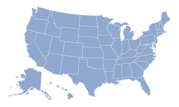
Downloadable map of United States of America. The spatial locations of Hawaii, Alaska and Puerto Rico approximately represent their actual locations on the earth.

Taken in a New England style front yard in Cape Cod, MA
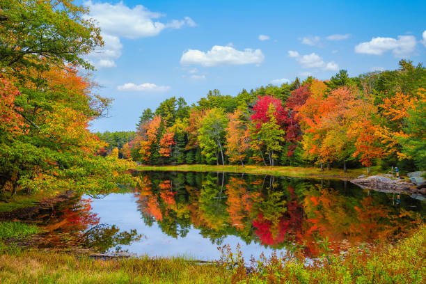
Colorful foliage tree reflections in calm pond water on a beautiful autumn day in New England

New England region of the United States of America, gray political map. Maine, Vermont, New Hampshire, Massachusetts, Rhode Island and Connecticut with capitals and borders. Illustration. Vector.

Lighthouse, Beach, Natural Landmark, Sea, Summer
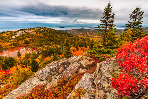
Orange red and yellow colors of the trees and plants in Acadia National Park in October

Colorful, charming stores in downtown Salem, Massachusetts, USA

New England Winter Wonderland. Colorful lavender pink sky and trees covered in blanket of fresh white snow. Image captured just before sunset as sky cleared following departing snowstorm.

Portland, Maine, USA downtown city skyline at dusk.
Next