Images
Massachusetts Pictures, Images and Stock Photos
Browse 103,100+ massachusetts stock photos and images available, or search for massachusetts map or massachusetts state house to find more great stock photos and pictures.
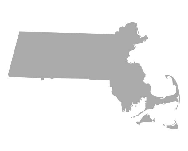
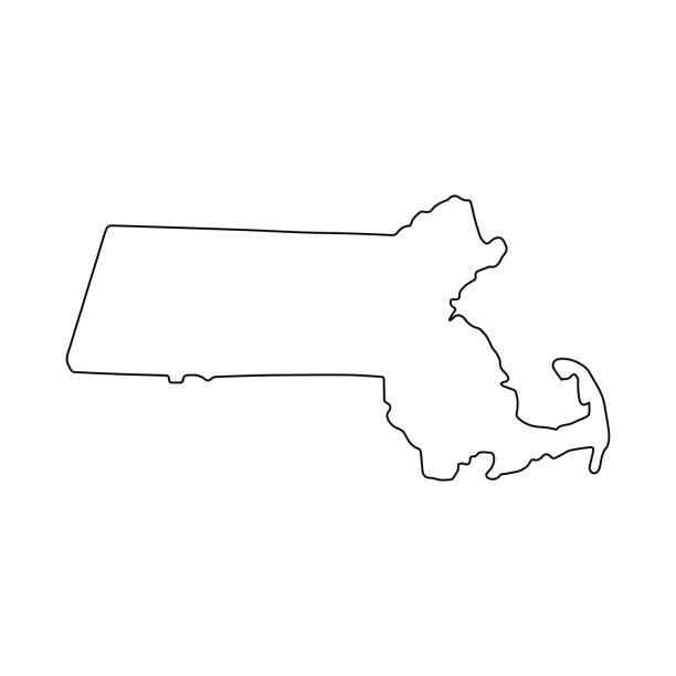
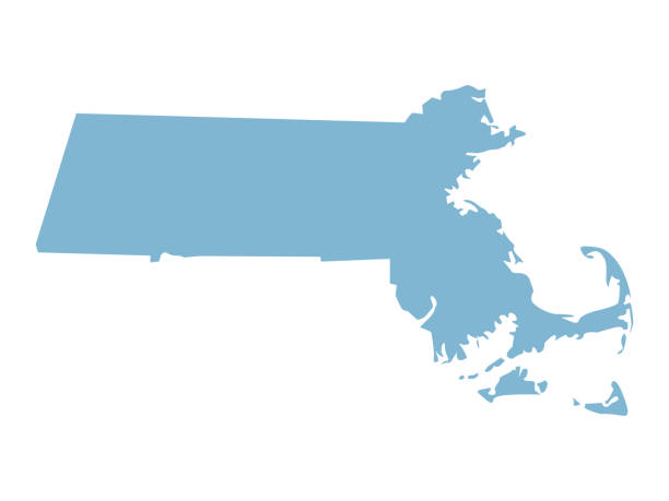
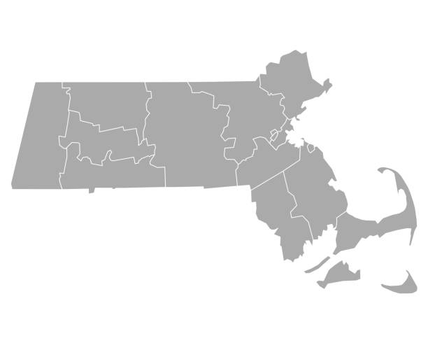
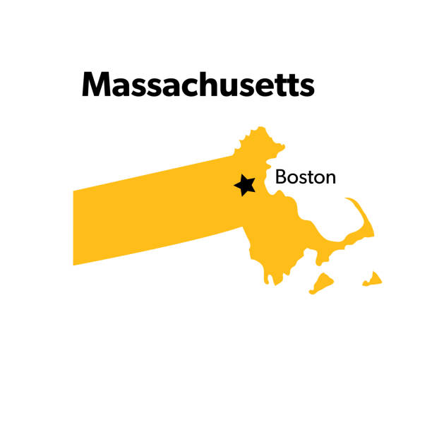
massachusetts map
massachusetts state house
boston
massachusetts seal
michigan
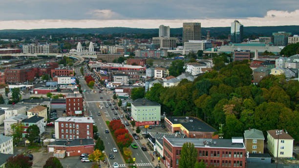
worcester massachusetts
boston massachusetts
salem massachusetts
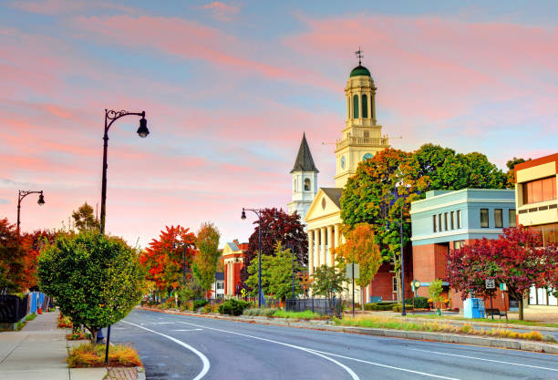
springfield massachusetts
cambridge massachusetts
berkshires massachusetts
plymouth massachusetts
western massachusetts
massachusetts beach
massachusetts landscape
waltham massachusetts
massachusetts winter
massachusetts state
massachusetts flag
provincetown massachusetts
lowell massachusetts
amherst massachusetts
massachusetts home
concord massachusetts
brockton massachusetts
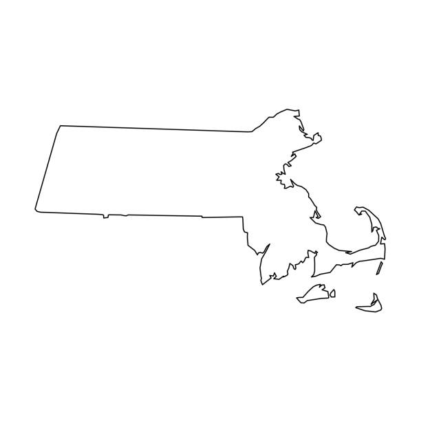
massachusetts outline
lenox massachusetts
quincy massachusetts
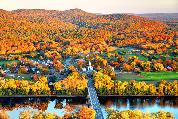
massachusetts fall
massachusetts neighborhood
Most popular
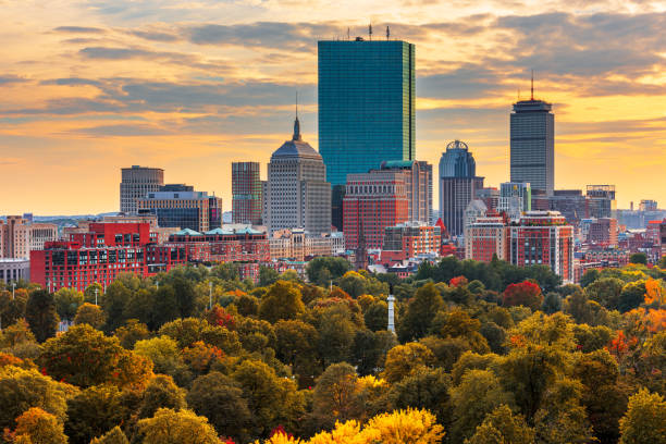
Boston, Massachusetts, USA skyline over Boston Common.
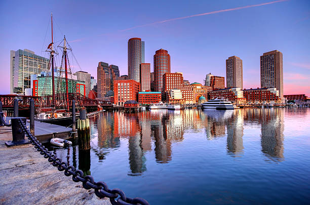
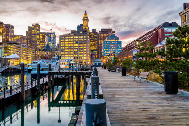
Downtown Boston Skyline along the Boston Harbor Waterfront. Photo taken along the harborwalk in the South Boston southie neighborhood. The Boston cityscape is a mixture of old and new buildings. Boston is the capital and largest city in Masssachusetts. Boston is the largest city in New England
Massachusetts State Concept
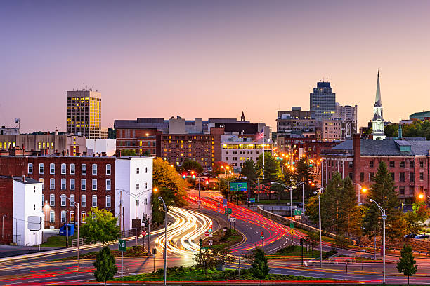
Worcester, Massachusetts, USA Skyline at rush hour.
Highly detailed map of Massachusetts for your design and products.
Boston, Massachusetts, USA city skyline on the river.
Drone shot of Cape Cod Bay at sunset on a sunny day in Fall, close to the town of Barnstable. Authorization was obtained from the FAA for this operation in restricted airspace.
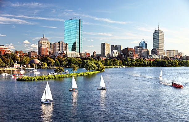
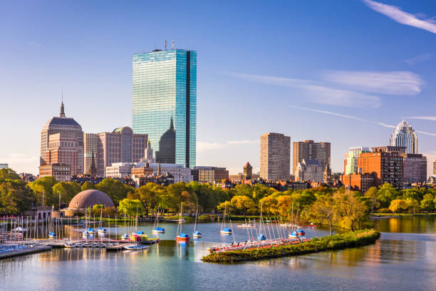
Sailboats on the Charles River with Boston's Back Bay skyline in the background. Boston is the largest city in New England, the capital of the state of Massachusetts. Boston is known for its central role in American history,world-class educational institutions, cultural facilities, and champion sports franchises.
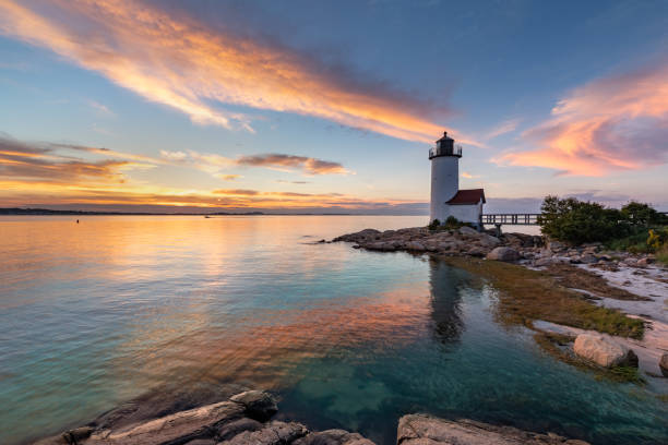
Annisquam Harbor Light Station is a historic lighthouse on Wigwam Point in the Annisquam neighborhood of Gloucester, Massachusetts.
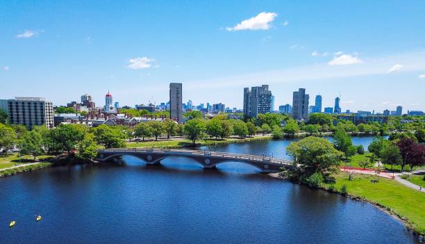
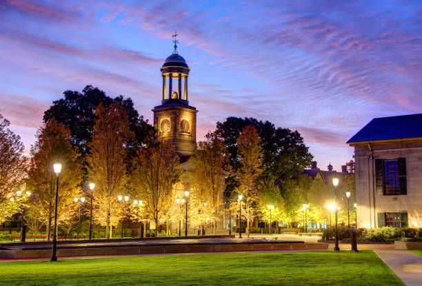
Weeks Bridge of Harvard University
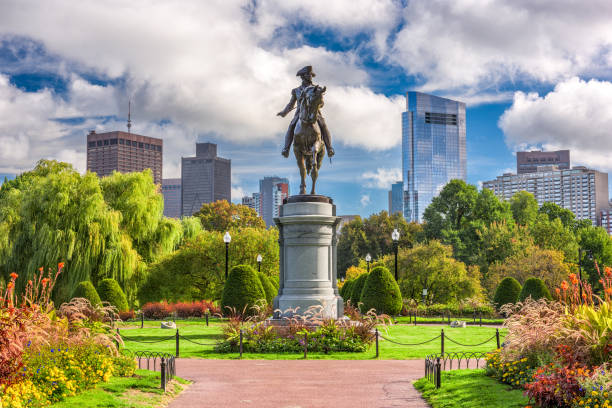
George Washington Monument at Public Garden in Boston, Massachusetts.
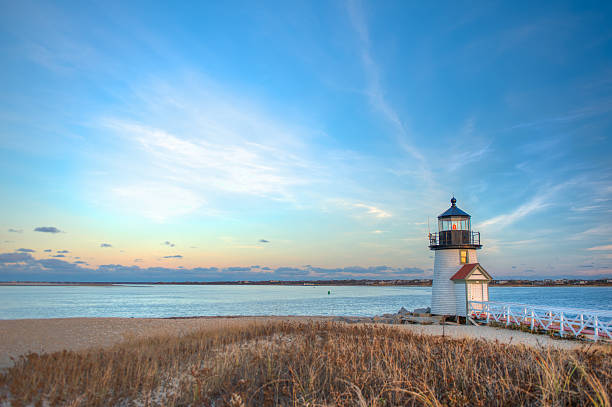
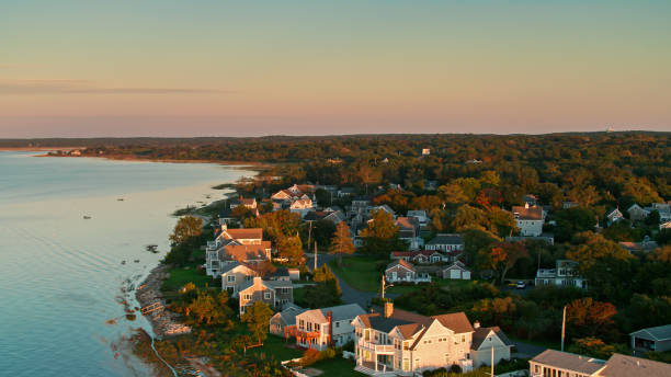
Landscape image taken from shore on a desolate day at Brant Point in Nantucket MA
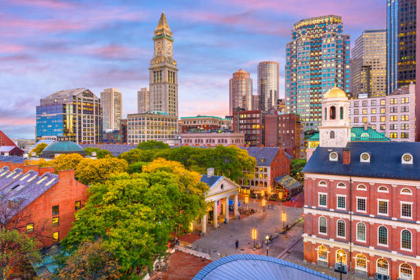
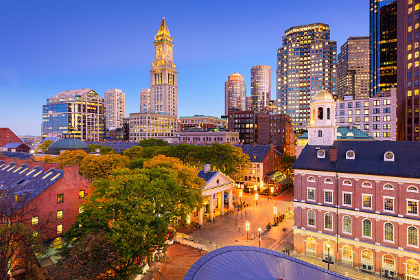
Boston, Massachusetts, USA skyline over Quincy Market.
Line USA state, American map illustration, America vector isolated on white background, outline style
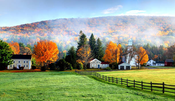
Autumn fog in the village of Tyringham in the Berkshires region of Massachusetts
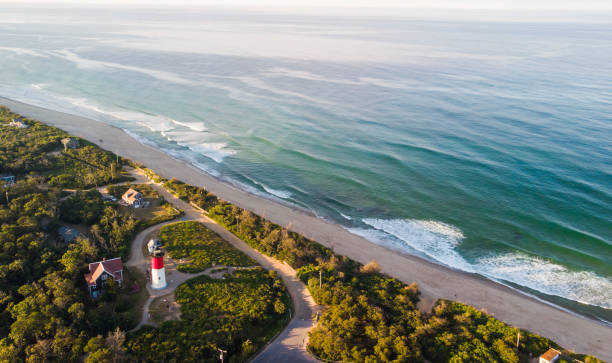
Nauset Beach with Nauset Light, aerial view
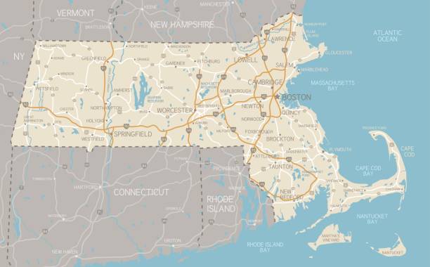
A detailed map of Massachusetts state with cities, roads, major rivers, and lakes. Includes neighboring states and surrounding water.

Boston, Massachusetts, USA cityscape with the State House at dusk.
Salem is a city in Essex County, Massachusetts, in the United States. Salem was one of the most significant seaports in early America and much of the city's cultural identity is reflective of its role as the location of the Salem witch trials of 1692
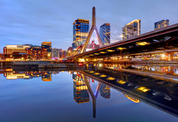
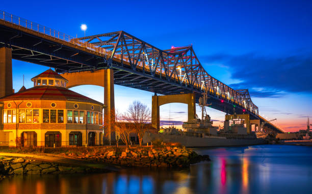
The Leonard P. Zakim Bunker Hill Memorial Bridge is a cable-stayed bridge completed in 2003 across the Charles River in Boston, Massachusetts.
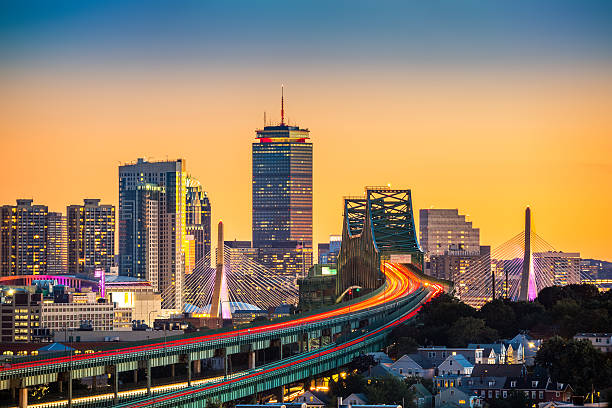
Rush hour traffic on Tobin bridge (aka Mystic River bride) heading towards Zakim bridge and Boston skyline at sunset.
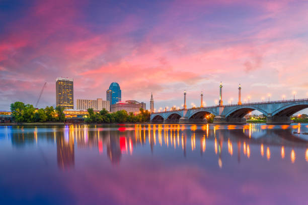
Springfield, Massachusetts, USA downtown skyline on the river at dusk.
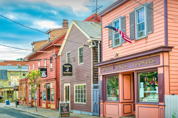
Colorful, charming stores in downtown Salem, Massachusetts, USA
vector illustration of Massachusetts map
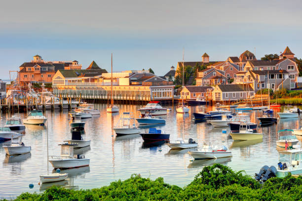
Harwich is a New England town on Cape Cod, in Barnstable County in the state of Massachusetts in the United States.
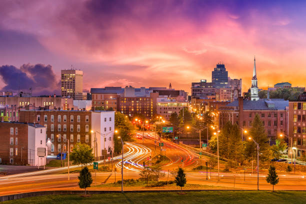
Worcester, Massachusetts, USA downtown skyline.
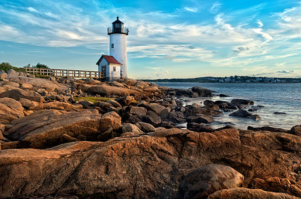
Annisquam lighthouse located near Gloucester, Massachusetts
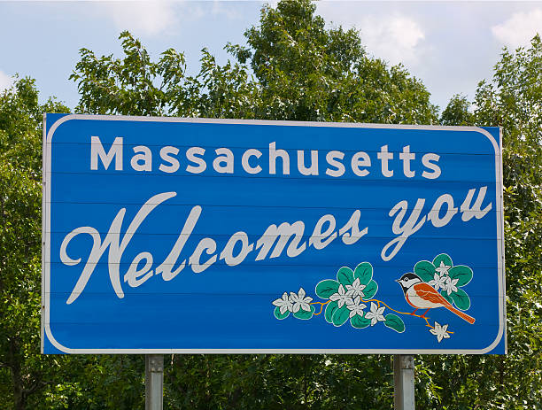
Welcome to Massachusetts road sign.

Cambridge, Massachusetts, USA skyline at twilight.
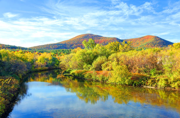
Connecticut River winding through the Poineer valley region of Massachusetts. Photo taken from a scenic viewpoint on Sugurloaf Mountain in Sunderland at dusk. The Pioneer Valley is known for its scenery and as a vacation destination and its beautiful fall foliage ranks with the best in New England
Medford is a city 3.2 miles northwest of downtown Boston on the Mystic River in Middlesex County, Massachusetts, United States.
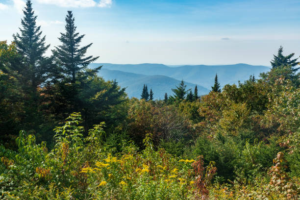
Lush vegetation, rolling green mountains, and a clear blue sky make this an idyllic photo of Mount Greylock in North Adams, Massachusetts.
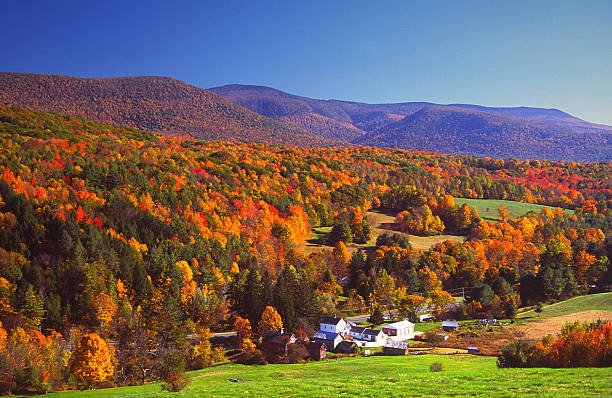
Autumn foliage in the Bershire Hills region of Massachusetts. Photo taken from a scenic viewpoint of the Mount Greylock Range during the peak fall foliage season. The Berkshires region enjoys a vibrant tourism industry based on music, arts, and recreation.
Pittsfield is the largest city and the county seat of Berkshire County, Massachusetts, United States.

An American flag flies from the open porch and gardens surround a small single family home on a Spring afternoon on Cape Cod on the Massachusetts coast.
Aerial view from over Shrewsbury St. looking towards Union Station in downtown Worcester, Massachusetts. Authorization was obtained from the FAA for this operation in restricted airspace.

A residential road in Newton, MA in fall

the flag of the US state of Massachusetts waving in the wind with the American flag blurred in the background. Massachusetts was admitted to the Union on February 6, 1788 as the 6th state
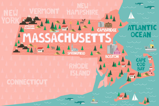
Illustrated map of the state of Massachusetts in United States with cities and landmarks. Editable vector illustration
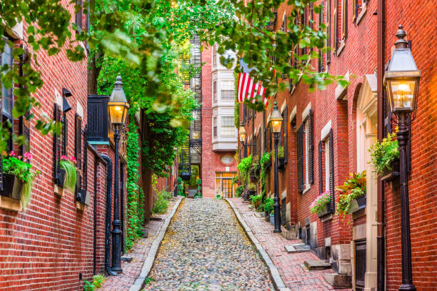
Acorn Street in Boston, Massachusetts, USA.
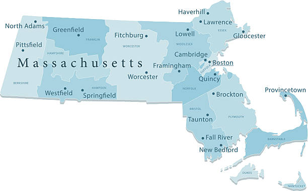
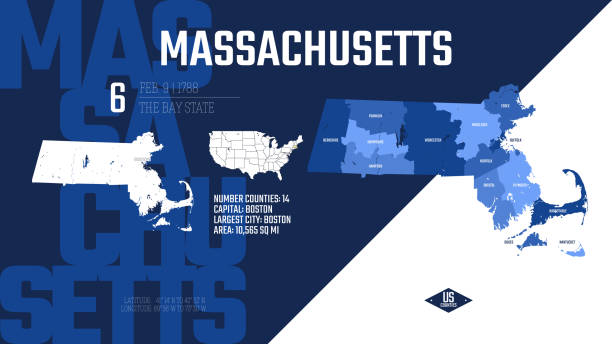
Detailed vector map of Massachusetts with administrative divisions. File was created on December 5, 2012. The colors in the .eps-file are ready for print (CMYK). Included files: EPS (v8) and Hi-Res JPG (5600 × 3733 px).
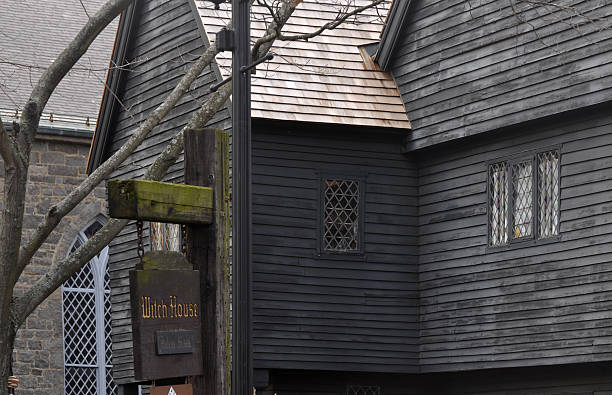
The Judge Jonathan Corwin House also known as The Witch House: Black old historical house in Salem, MA, is the only structure still standing in Salem with direct ties to the Witchcraft Trials of 1692. As a local magistrate and civic leader, Corwin was called upon to investigate the claims of diabolical activity when a surge of witchcraft accusations arose in Salem and neighboring communities.
Quincy is the largest city in Norfolk County, Massachusetts, United States. It is part of Metropolitan Boston and one of Boston's immediate southern suburbs.
Panoramic view of the historic architecture of Boston in Massachusetts, USA.
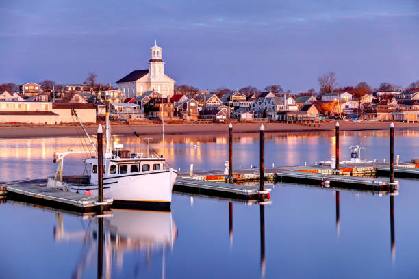
Provincetown is a town located at the extreme tip of Cape Cod. Sometimes called P-town the town is known for its beaches, harbor, artists, tourist industry, and its reputation as a gay village.
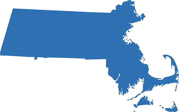
Vector illustration of a blue Massachusetts state icon with shadow.
Isolated U.S.A State With Capital City
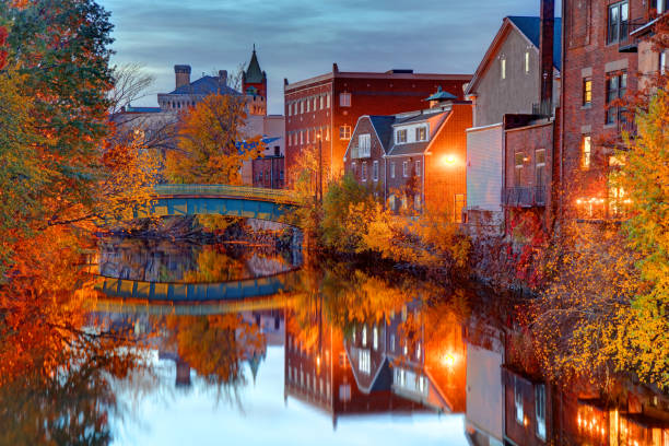
Dramatic twilight sky and reflections over the Fall River at Heritage State Park in Fall River, Massachusetts.

Massachusetts State House in Boston, Massachusetts, USA
Boston, Massachusetts, USA downtown cityscape.
Massachusetts, state of USA - solid black outline map of country area. Simple flat vector illustration.

vector illustration of Circle state flag of US federal state of Massachusetts
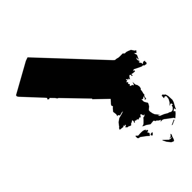
Massachusetts, state of USA - solid black silhouette map of country area. Simple flat vector illustration.
The Berkshires are a highland geologic region located in the western parts of Massachusetts and northwest Connecticut. Berkshires region enjoys a vibrant tourism industry based on music, arts, and recreation

A shot of Worcester Cathedral taken with a drone looking from Fort Royal Park.
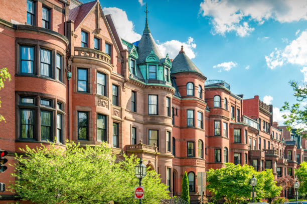
Typical brownstone townhouses in Back Bay district of downtown Boston, Massachusetts, USA on a sunny day.
Next